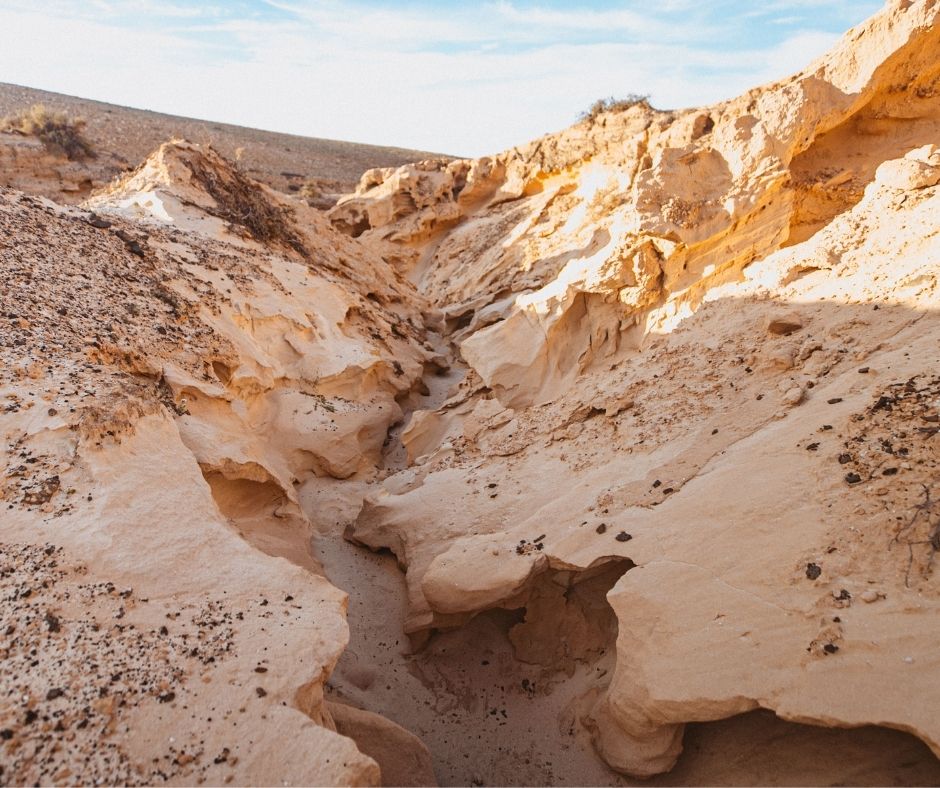
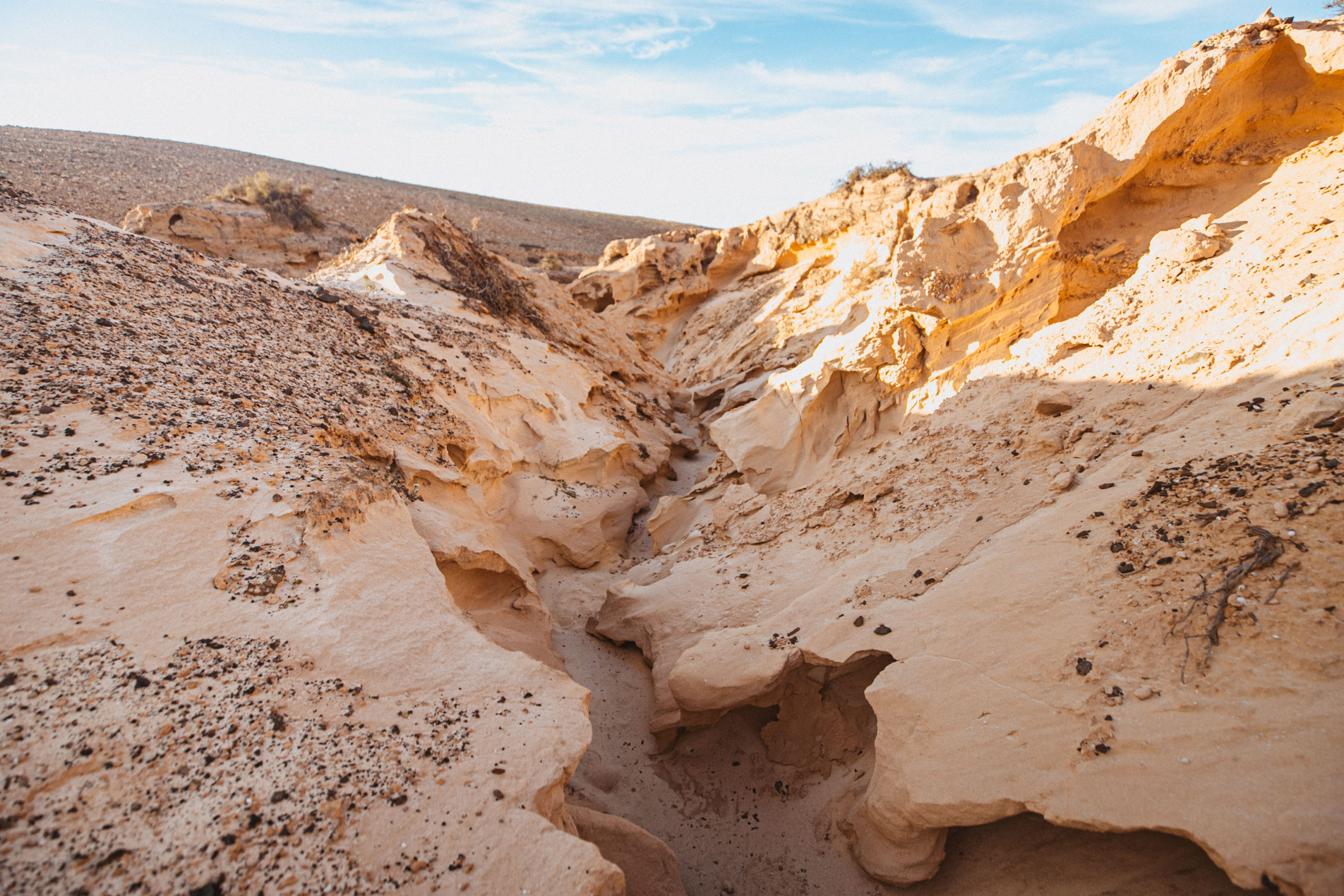
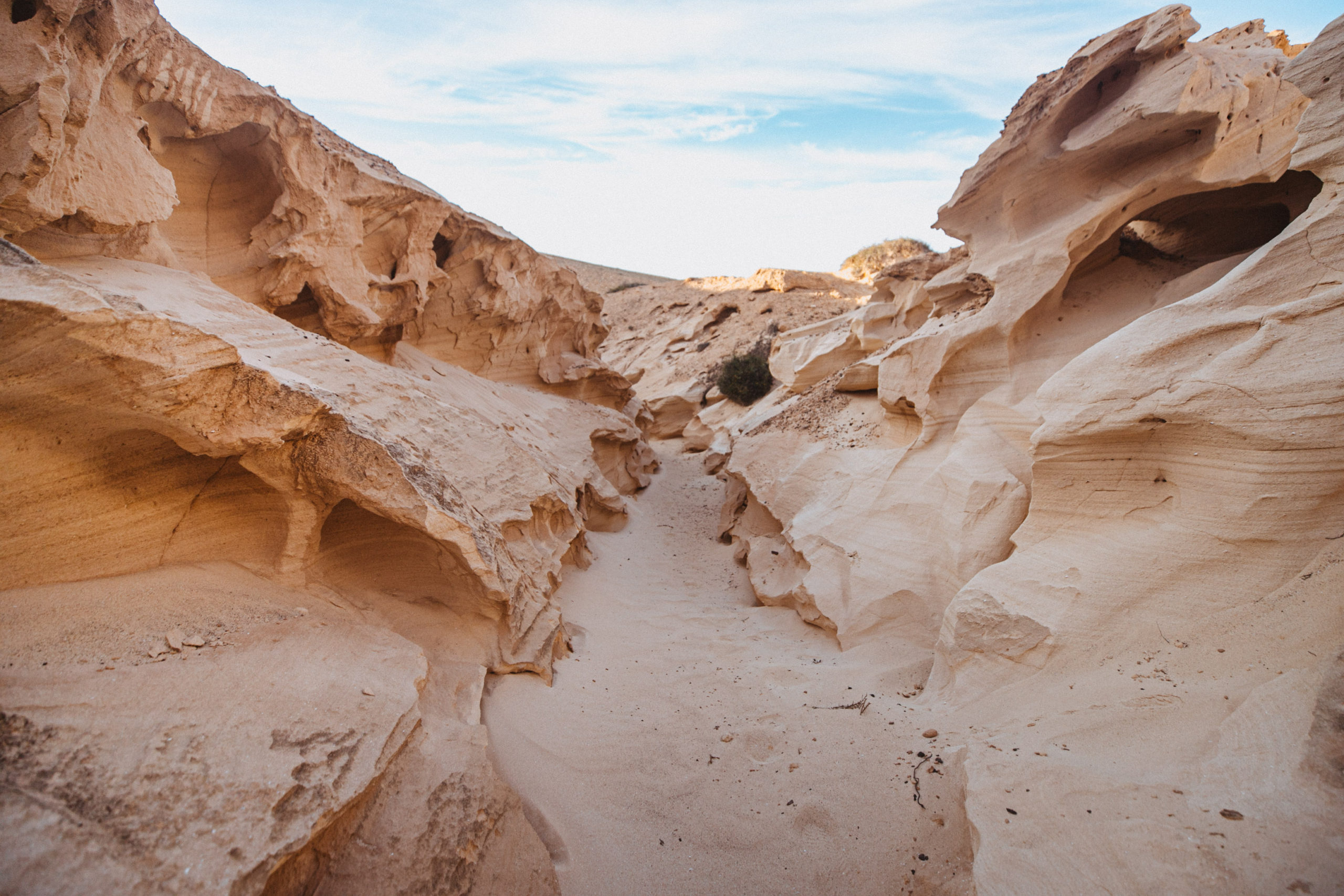
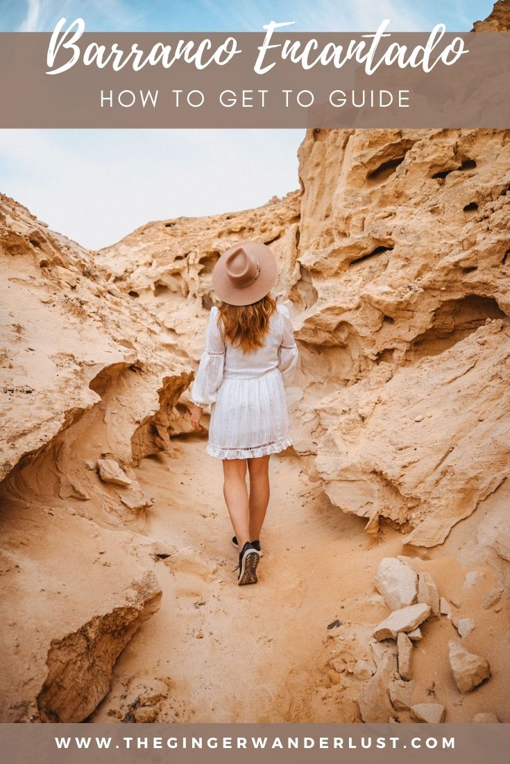
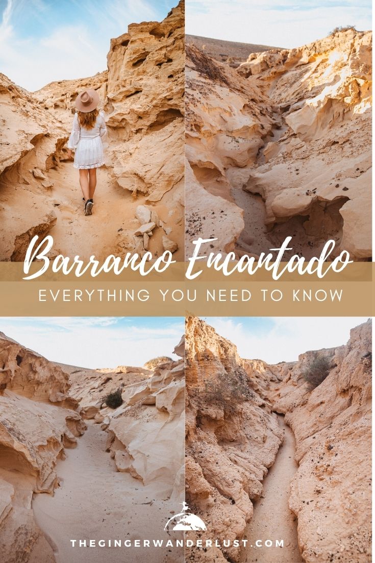
The Canary Islands have a number of different ravines known as ‘barrancos’ in Spanish. They are primarily dry and make for very unique locations to explore and photograph. The most peculiar ravine that I came across is definitely the Barranco Encantado (also known as the Barranco de los Enamorados) in the north of Fuerteventura. This barranco is lined with fossilised dunes that have been shaped by water and wind over thousands of years, it really reminded me on Antelope Canyon in the USA. Although it is pinned in Google Maps it isn’t the easiest place to find (it also has two entrances) so keep reading to find out how to get to the Barranco Encantado.
How to get to the Barranco Encantado
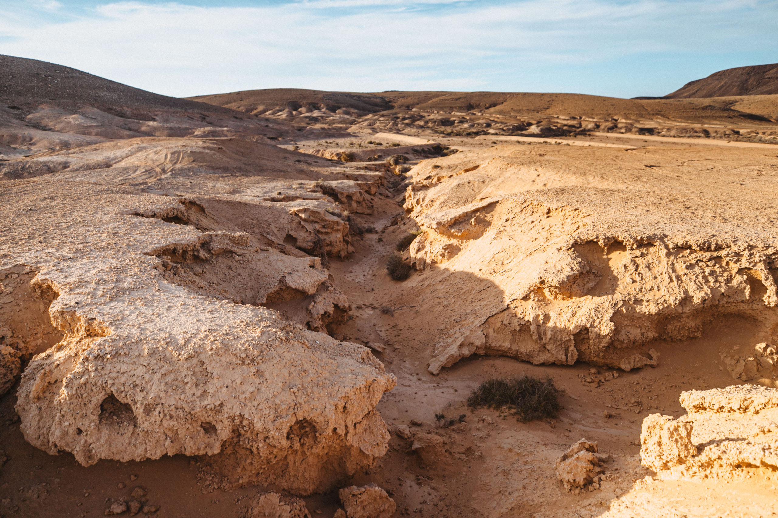
The Barranco Encantado (or Barranco de los Enamorados) is about 3km long one way and you can access it from two sides. In this article I will share how to get there from both the north and the south entrances. If you want to explore the entire ravine (6km total) you will need around 2.5 hours. Personally I found the ravine to be more impressive to the north as there are actual canyons so if you have limited time I would aim for there.
How to get to the Barranco Encantado – south entrance
Step 1 – Go to El Cotillo
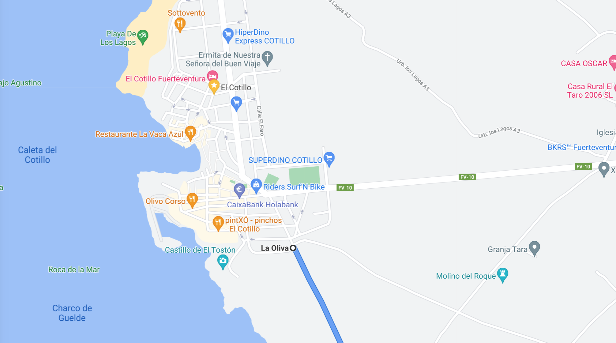
The southern access to the Barranco Encantado is the most common entrance as it is where Google Maps will take you. The road taking you to this point on Google Maps starts in El Cotillo. You will find it to the south of the town, near the Castillo de El Toston.
Step 2 – Drive down the dirt path
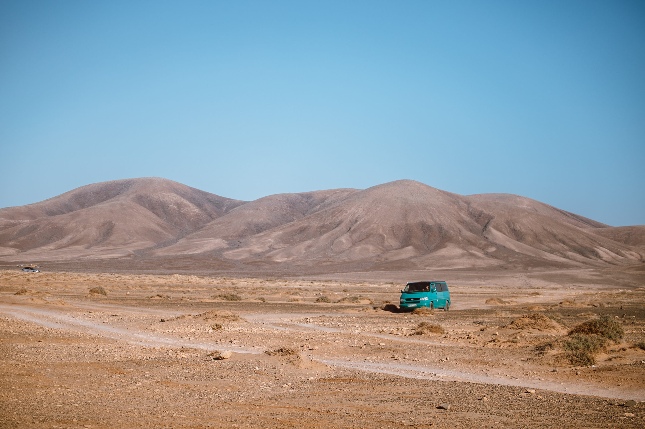
The parking area for the Barranco Encantado is at the end of a dirt road about 7km long. If you drive slowly you don’t need a 4×4 to navigate the road as it’s very flat. The drive has a number of popular scenic beaches and instagrammable photo spots in Fuerteventura like the Playa del Aguila. So make sure to factor in some extra time so that you can stop a few times.
Step 3 – Stop at the parking
Google Maps should take you to the best spot to park at the entrance of the barranco, and hopefully you will see other cars parked. I have shared a pin below just in case you have any problems. Make sure to save this pin as you probably won’t have signal there.
Step 4 – Start hiking through the Barranco Encantado
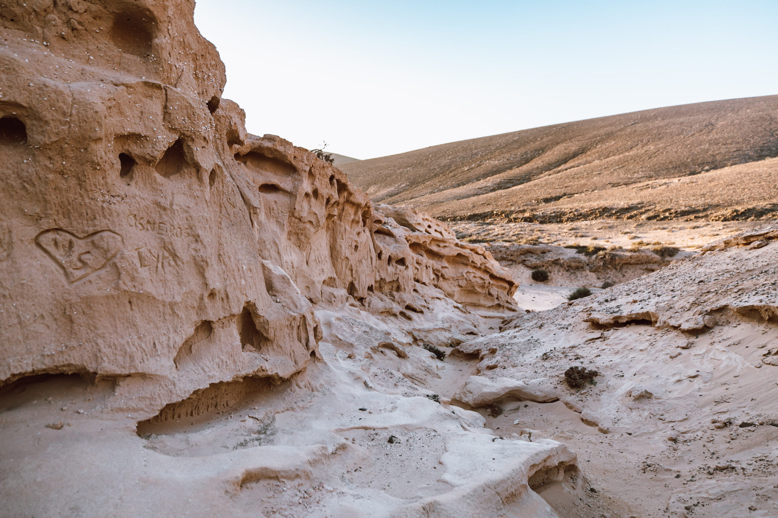
It will take you about 20 to 30 minutes to hike to the first part of the barranco. The path is very straight forward to follow. This part is impressive but unfortunately it has been somewhat vandalised by names engraved into the sides. Please respect the area and don’t leave any traces of your visit.
The Barranco Encantado is about 3km long (one way) so will take you about 2.5 hours to complete, I recommend hiking to the northern part of the ravine as you will find some impressive canyons. Check out the map under the how to get to the Barranco Encantado – north entrance to see my favourite instagrammable photo spots in the Barranco Encantado.
How to get to the Barranco Encantado – north entrance
Step 1 – Head to the roundabout just west of Lajares.
You will find the start of the northern entrance to the Barranco Encantado to the west of Lajares. Head to the roundabout where the road FV-10 and FV-109 meet and take the exit onto the dirt path. I have pinned the exact location onto the map below.
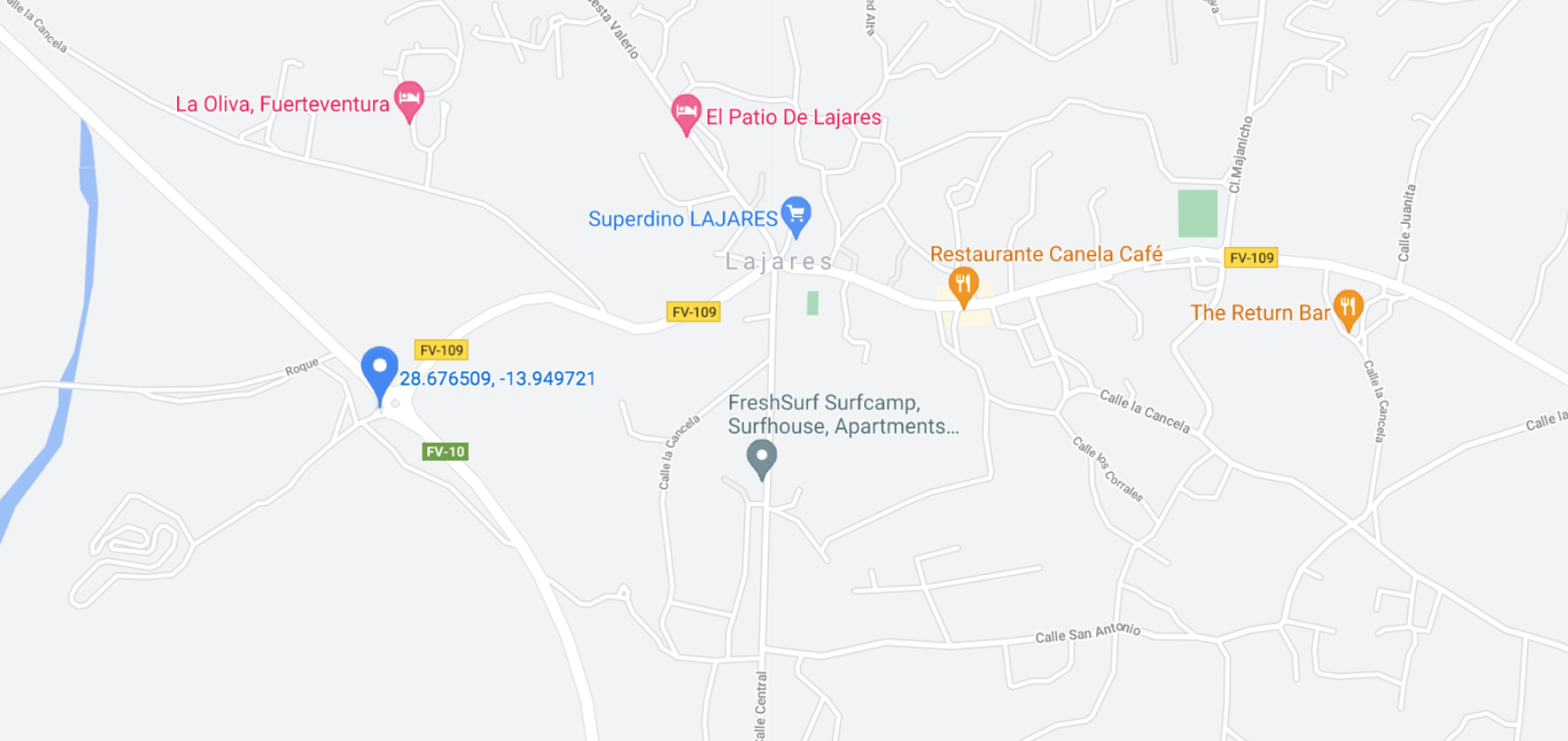
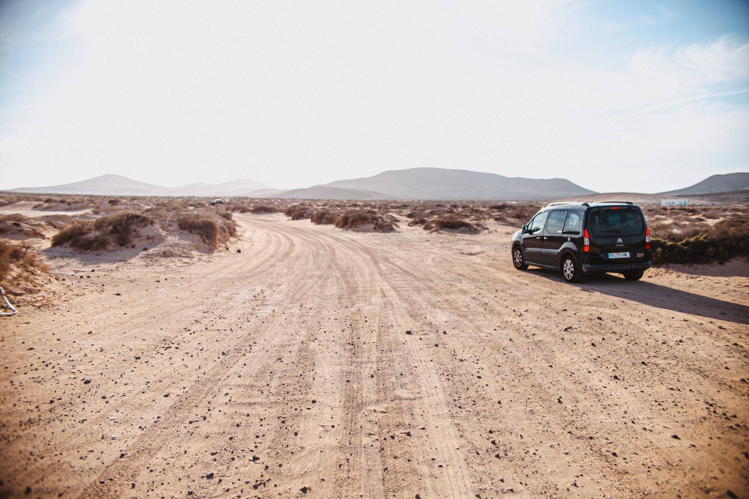
Step 2 – Drive down the dirt road
Once you’ve found the entrance to the dirt road you will need to drive for about 10/15 minutes to the site of the first barranco. I have pinned this on the map below. I do not advise driving past this point. Alternatively you can also park near the roundabout and then walk the whole way.
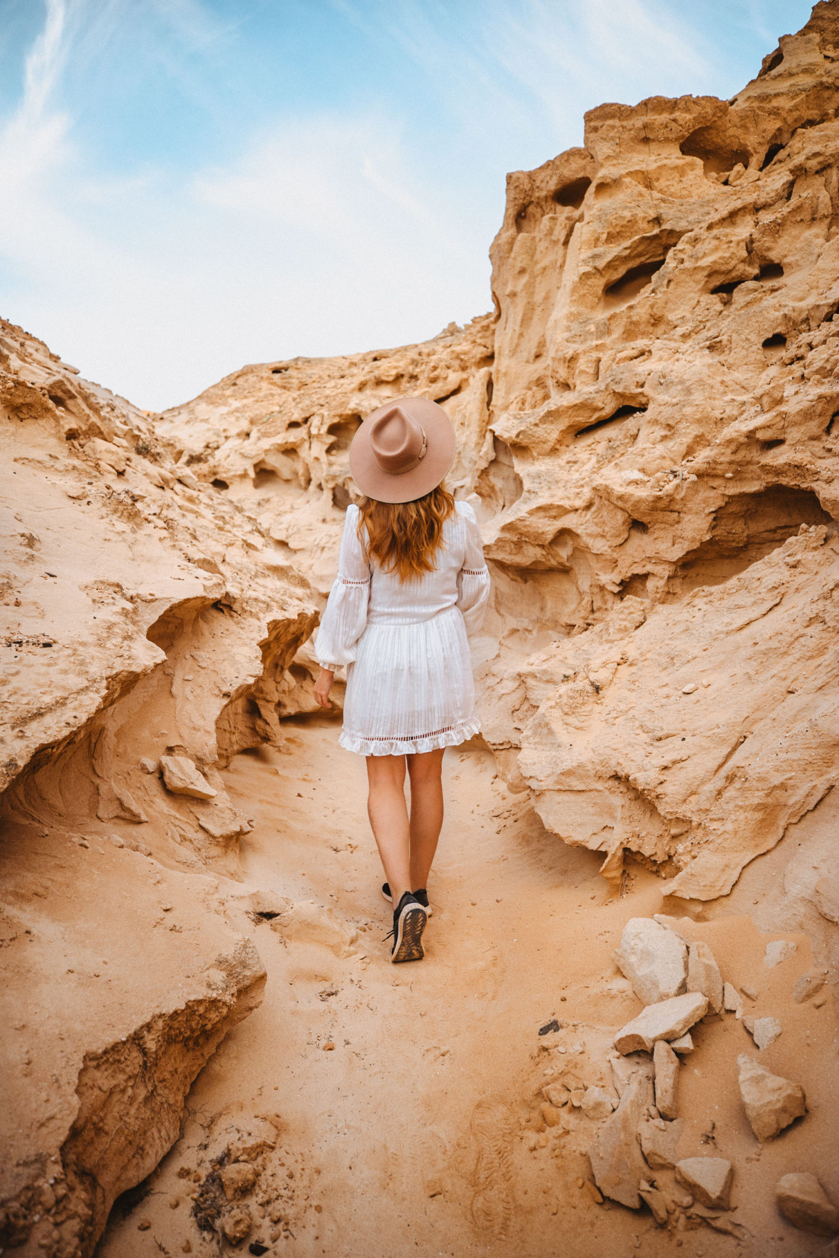
Step 3 – Explore the Barranco Encantado
The barranco is about 3 km long (one way) so will take you around 2.5 hours to do it all. I have pinned my favourite locations in the map below. There are a number of different interweaving paths to follow so I recommend exploring and enjoying yourself!
What should I bring to the Barranco Encantado
The barranco Encantado is in the middle of nowhere so I recommend bringing water with you, as well as closed shoes for exploring. The majority of the path is in full sunshine so if you go during the middle of the day you might also want to bring suncream and a hat. I went a few hours before sunset which is why the barranco looks like it’s in the shade in my photos.
Where should I stay?
The barranco is located to the north of Fuerteventura so for easy access I would stay in either Corralejo or El Cotillo. I personally stayed in Corralejo and recommend either the Dunas Club or Brazan Holidays.
I hope you found my guide on how to get to the Barranco Encantado (also known as the Barranco de los Enamorados) useful, and that you enjoy exploring these unique and beautiful canyons. It is definitely a must see place in Fuerteventura.
Like this post? Pin it to save for later!
No Comments